
 A great place to mountain bike in Arizona is the Rainbow Rim Trail. This trail is located along the edge of the north rim of the Grand Canyon. Unlike the south rim the north rim has areas along the rim that are not in the National Park. And unlike the south rim the north rim is not very crowded with tour buses and tourists. There are areas on the south rim where you can park right at the rim and throw out a tent and set up camp.
 Anyway back to the mountain bike trail. This trail is eighteen miles of fine single track running along the rim of the Grand Canyon. Along this eighteen miles are five points that stick out into the canyon. The trail follows the rim and then goes in away from the rim to negotiate around drainages or washes to eliminate large elevation changes and then returns to the rim and then out to the next point or (view point).
 I have heard that the trail was made with mountain biking in mind, and as you ride it it feels that way. The climbs are not too difficult and the path is smooth and not too technical. And of course the views are world class. Don't get to involved in looking at the views while riding because if you go off the edge it's a long way down.
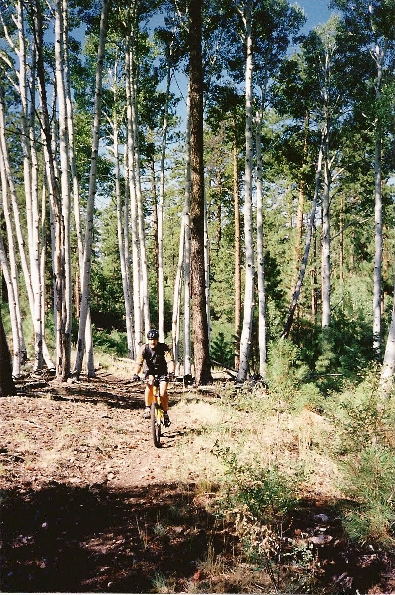 The trail runs between Timp Point in the south to Parissawampitts Point in the north. And the trail can be accessed from roads at any of the other three points along the way (North Timp Point, Locust Point, and Fence Point). The terrain is a most beautiful forest filled with an assortment of pines and aspen trees. This is high elevation country and the the trail is between 7500 ft. and 8000 ft. in elevation. In summer the temperatures are nice. But this area is closed in the winter due to deep snow. So the area opens May 15th and closes around October 15th.
 Camping at any of the points is free. There are no facilities and it is about 43 miles back to Jacob Lake so bring plenty of food and water. You should bring rain gear because there is often rain during summer monsoon season. Here is a trail map I found at Epicenter's Singletrack.us.
Center. About 0.7 miles past the entrance to the DeMotte Campground entrance you turn right or west on Forest Road (FR) 422. You takes this about 2 miles and then turn south or left on FR270. After about a mile you turn west or right on FR222 and take this for 5 miles to FR206 where you go only a quarter mile and then take FR271. You follow FR271 for 8 miles to Timp Point. While you are on the north rim be sure to go to the Lodge at the National Park, because it's not too crowded and real nice! There is also some great single track riding along the Arizona Trail running north from the National Park toward Jacob Lake. If you go to the Kaibab Plateau Visitor Center they can give you more information.
While you are on the North Rim there is also a great section of the Arizon Trail that you can ride. I had my wife drop me off and I rode a section and she picked me up latter in the day at a pre-determined location farther south on the trail. Here is a good map (again from singletrack.us) for a nice part of that trail.

No comments:
Post a Comment